ProFarm by Farmers Cooperative is a service-based program to help you take advantage of data generated by precision ag technology on your equipment. The goal is to improve the profitability of each acre by being more efficient with inputs. Through ProFarm, we help you understand the specific needs of a field to maximize its potential. We combine your knowledge and data with our agronomic expertise to provide you with superior agronomic recommendations. Enroll in ProFarm to become eligible for discounts on soil sampling, drone imagery and other services.
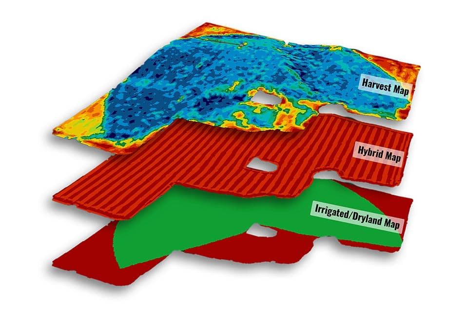
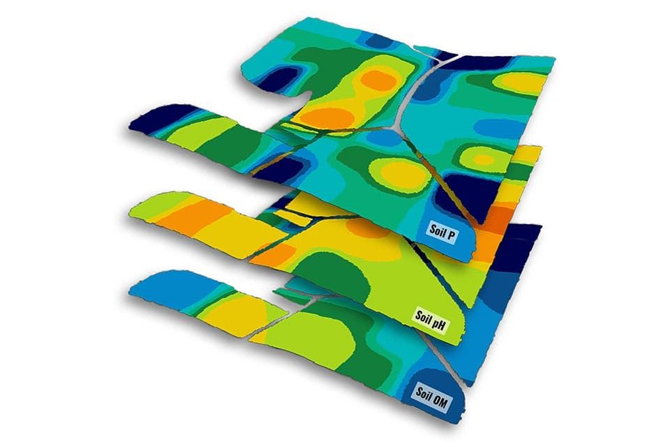
Variable rate prescriptions are designed to increase return-on-investment (ROI) by optimizing the input's rate and placement. Our prescriptions are created using custom-made management zones and our proprietary equations. Management zones are typically made from yield data, but also can be made using imagery, electrical conductivity data (EC data) and/or Natural Resource Conservation Service (NRCS) soil maps. Types of prescriptions:
We make it easy for you to see the yields of your fields through an easy-to-read book. It's packed with valuable information like yield maps, planting maps and management zones. We can analyze any data layer against your yield data to determine what practices and inputs give you the highest ROI. Common analyses:
Satellite imagery is perhaps the most common imagery source used in agriculture today. It is used for in-season field monitoring, creating management zones and side-dress nitrogen prescriptions. Image frequency can be as be as often as one image every few days when cloud obstruction is minimal. Benefits:
Variably applying fertilizer based on soil sample results helps correct nutrient variability. You can increase yields and save money by applying adequate amounts of fertilizer in areas with low nutrient levels and not applying fertilizer in areas with high nutrient levels. Types of soil sampling include:
We can manage soil moisture by installing sensors early in the crop's development. Sensor(s) are installed between two healthy plants and measure actual soil moisture content. Benefits:
Get relevant weather data delivered to your phone with a weather station installed on your farm.
We can measure:
Drone imagery provides the highest resolution imagery available, so we can diagnose issues without setting foot in the field. Benefits:
This farm management software helps you plan your season crop inputs to gain efficiency and minimize risk. Track inputs, map fields, manage inventories and securely store data, all in one place. Key features:
Record our planting, as-applied nutrients and harvest data to an iPad during operations. Sync the data to the cloud and access your data from anywhere via phone, tablet and computer. Key features:
Farmers Cooperative has invested in 8 weather stations that are positioned throughout our trade area. These weather stations will offer our patrons and employees with a number of real-time weather variables that can be used for a variety of purposes. The weather data is also saved so going back and viewing previous weeks even years is only a click of a button. The weather data can be accessed from a phone (app), tablet, and computer. Farmers Cooperative is providing the weather data to our patrons free of charge. If you are interested, please request more information below. 3 ways weather data can be beneficial on your operation:
Real-time, local research and insights from Answer Plot® and Insight Trials to help you decide which seed products should be part of your game plan for the next season Every fall, we...
...